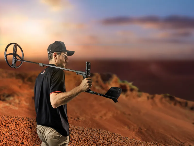
GO TERRAIN by XP – the complete practical guide
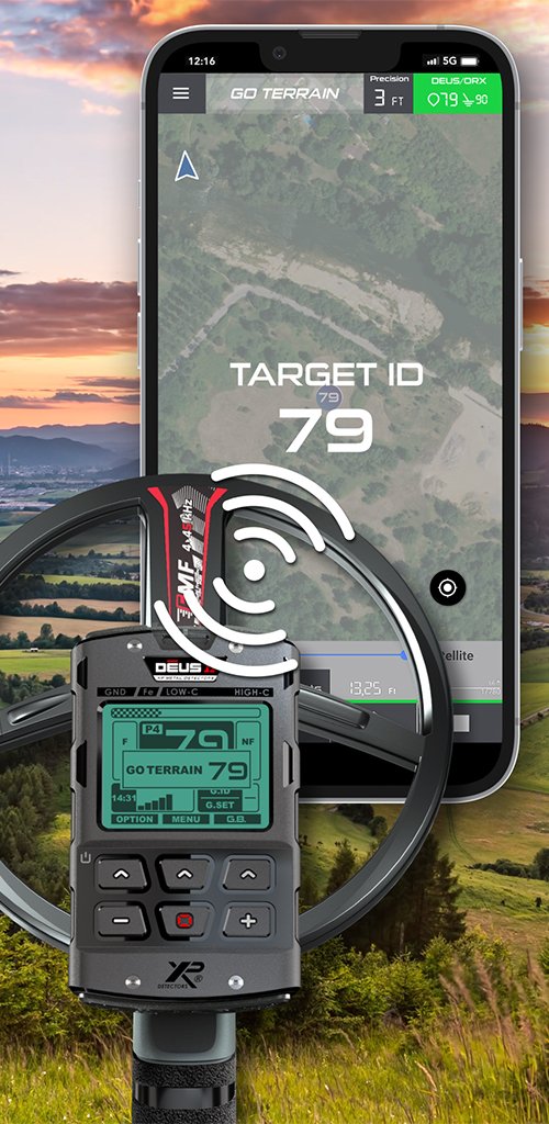
GO TERRAIN is the terrain, find and route documentation app from XP Metal Detectors for Android and iOS. It records your detecting sessions, sets find markers with GPS position and documents every find including photo, audio and video. In principle, the app is brand-independent – finds can be entered manually with any detector. With the DEUS II, DEUS/WS6 MASTER and ORX (and partly the XTREM HUNTER), target ID and ground information are also transferred directly via Bluetooth . For later evaluation on the PC: KML is the best choice for Google Earth and BayernAtlas, GPKG/GeoPackage is the complete professional backup including media and ideal for QGIS.


- Platform
- Android & iOS
- Brands
- brand-independent; Bluetooth transfer with XP
- Directly pairable
- DEUS II · DEUS/WS6 MASTER · ORX · XTREM HUNTER (PUSH only)
- Cost
- Standard free · Premium as a low-cost annual subscription
- Map export
- KML (Google Earth, BayernAtlas)
- Professional export
- GPKG for QGIS (Premium)
- Current version
- Version 3 (June 2026)
- Available in
- over 170 countries
Overview: what GO TERRAIN does
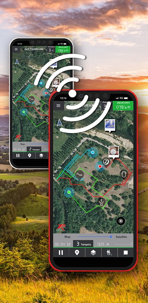
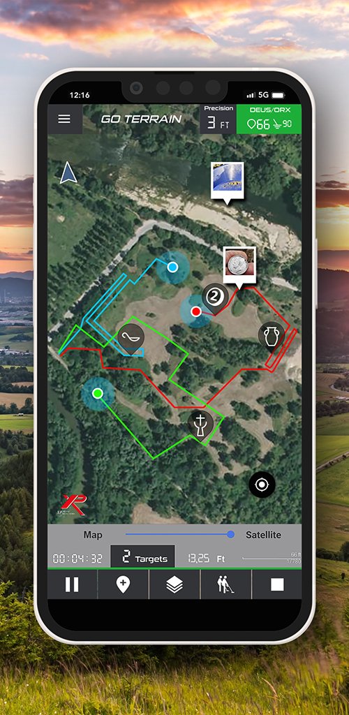
GO TERRAIN makes your detecting sessions spatially traceable. The app records the route you walked, sets find markers with GPS position, documents the find data and allows later evaluation on your smartphone or computer. XP now explicitly describes the app as usable across brands; the real added value of an XP detector remains the automatic data transfer via Bluetooth.
Routes & tracks
Recording of search routes including distance, time and all find positions.
Find markers
Name, date, size, weight, target ID, period, material and free text for each find.
Media per find
Up to three photos, one audio recording and one video directly at the find marker.
Target ID via Bluetooth
With XP detectors, conductivity/target ID and ground information are transferred.
Search areas & zones
Draw, import and export areas – optionally with a warning when leaving them.
History & group
Show earlier tracks, group mode, heatmap and cloud sync (Premium).
Important regarding accuracy: The find position is always the position of the phone at the moment of saving – not exactly the position of the coil. For better GPS quality, carry your smartphone on your upper arm or in a chest pocket; in a trouser pocket, body shadowing and changing orientation reduce accuracy.
What GO TERRAIN looks like
Free or Premium?
The standard version is free and covers track recording, find markers, manual entry and Bluetooth transfer with XP detectors. For team searches, cloud backup and professional data analysis, the Premium version is available as a low-cost annual subscription – XP itself describes the cost as roughly “the price of a coffee per month for a year”. As the price may vary by store and region, please check the current amount directly in the App Store or on Google Play.
| Feature | Standard (free) | Premium |
|---|---|---|
| Routes & find markers | yes | yes |
| Manual finds (all brands) | yes | yes |
| Bluetooth target ID (XP) | yes | yes |
| Export KML & GPX | yes | yes |
| Cloud synchronisation | – | yes |
| Group mode (live positions) | – | yes |
| Heatmap / find density | – | yes |
| Merge activities | – | yes |
| GPKG export & import | – | yes |
GO TERRAIN on video
A compact overview of how GO TERRAIN works in the field – from track recording to find documentation:
New in version 3 June 2026
The current major version 3 is aimed particularly at demanding users and at everyone who works with archaeological services and QGIS. The most important new features:
- GPKG import (Premium): exchange activities including photos/videos and use them as a complete backup.
- KML import of activities and search zones created in Google Earth.
- UTM coordinates for every target, automatically included in every export – regardless of format.
- Tag field for activities for easy categorisation (e.g. “Celts”, “field”).
- Weight per find.
- Switching between metric and imperial units.
- List of previously paired coils for quick switching.
- Redesigned activity and target management, easier renaming and deleting.
- Remove an activity from the cloud without deleting it from the phone.
- Batch export of media and deletion of several targets/media at once.
- Show tracks/targets of selected activities on the main map via history.
- Rally function: automatic import of search zones from large partner events.
- Warning when there is a risk of data loss (one account on several phones) and a reminder to make local backups after the third app start.
Requirements & permissions
On first start, GO TERRAIN asks for the following permissions depending on the function:
- Location/GPS: mandatory for track recording and find coordinates.
- Bluetooth: for the connection to XP detectors.
- Camera and microphone: for photos, videos and audio notes at the find.
- Mobile data/Wi-Fi: for maps, cloud synchronisation and group mode.
Pairing an XP detector (DEUS II / DEUS / WS6 MASTER / ORX)
- Switch on Bluetooth on your smartphone.
- Start GO TERRAIN.
- Open the detector connection in the app and select DEUS/ORX .
- Search DEUS/ORX or start the search.
- On the detector, under OPTION › SETTINGS/CONFIGURATION › GO TERRAIN activate the AUTO or PUSH mode.
- Sweep a target over the coil at least three times within five seconds.
- Tap the coil serial number shown in the app – the connection is established.
AUTO or PUSH – which mode when?
| Mode | Behaviour | Useful for |
|---|---|---|
| AUTO | The app receives target information automatically and places it on the map. By default, the same conductivity value must be detected three times within five seconds. | Clean, low-trash areas and documented grid/area searches. |
| PUSH | With the target ID displayed, hold the middle button of the remote control for about five seconds; only then is the point transferred. | Iron-contaminated ground, selective documentation and valuable individual finds. |
In AUTO mode, a find-rich or heavily iron-contaminated area quickly fills the map with points. For fields with a lot of scrap or targeted find scatters, PUSH is usually the cleaner way of working: you only transfer signals you really want to document. XP displays iron values from 0–19 as black dots to keep the display uncluttered. The XTREM HUNTER only works in PUSH mode; a long button press can also mark the current position with ID 99.
Avoiding connection problems
Modern Android and iOS power-saving mechanisms can restrict Bluetooth in the background. If find markers become unreliable:
- Keep GO TERRAIN open and in the foreground.
- Leave the display switched on and greatly reduce the brightness.
- Check the Bluetooth and location permissions.
- Deactivate power saving for GO TERRAIN or exclude the app from battery optimisation.
- Test before searching: sweep a test target three times and check whether the coil number or test point appears.
Practical workflow in the field
- Before starting: Select the map, check GPS, load or draw the search area, show the desired history.
- Start activity: Only then is the route recorded as a green line. Settings can be changed in pause mode.
- Set a find: automatically via XP AUTO, selectively via XP PUSH or manually by tapping your own position.
- Refine the find marker: The position can be moved on the map afterwards.
- Document the find: Add material, weight, dimensions, period, description, photo and, if applicable, audio.
- End activity: Give the track a meaningful name, tag it, check finds and delete incorrect points before saving.
- Back up immediately: Export the activity and/or create a local ZIP backup – do not rely solely on the cloud.
Recommended data structure
For long-term site analysis, a uniform naming and tag standard is worthwhile. An example:
- Activity name:
2026-08-28_field-west_parcel-XX - Tag:
Celts,Middle Ages,Field,Meadow,Follow-up search - Find name:
bronze-brooch_fragment_01,silver-coin_unidentified_02 - Description: Soil conditions, depth, signal behaviour, associated finds, context.
This allows you to later compare all activities with a given tag, or all non-ferrous find markers in an area, in GO TERRAIN, Google Earth or QGIS. Version 3 explicitly added a tag field for this purpose.
Export & backup
GO TERRAIN offers three relevant activity formats. Export via:
Menu › My activities › Select activity › Three-dot menu top right › Select export format. Media can also be exported separately from the gallery or find list.
| Format | Contains | Ideal for | Limitation |
|---|---|---|---|
| KML | Route, find markers, geodata; no media | Google Earth, BayernAtlas, find distribution | No embedded photos/videos/audio |
| GPX | GPS points and tracks; no media | GPS programs, track viewers, outdoor apps | Less suitable for complex GIS analysis |
| GPKG / GeoPackage | Complete data incl. media in one file | QGIS, GIS, long-term archive | Premium; not directly in Google Earth/BayernAtlas |
| ZIP backup | Local app backup of the database | Smartphone change, emergency recovery | Only readable with the same GO TERRAIN account |
Important backup rule: Logging out of GO TERRAIN can delete locally stored, unsynchronised activities, find markers and tracks. Therefore, always create at least one local ZIP backup before changing apps, changing smartphones, reinstalling or logging out and additionally a KML/GPKG export to your PC. Cloud synchronisation does not replace your own backup.
Recommended 3-2-1 practice
- One working copy on the smartphone.
- One copy on the PC/NAS.
- An additional copy on a separate storage medium or in encrypted cloud storage.
- For the map view: export KML. For the complete archive with media: GPKG (Premium). For app recovery: additionally a ZIP backup.
PC evaluation: Google Earth, BayernAtlas & QGIS
Google Earth
For Google Earth, the GO TERRAIN export as KML is the most direct route – KML displays points, lines and areas. In Google Earth Web you work most reliably with KML/KMZ: via New › Import file into project upload the .kmlfile and add it as a data layer. In Google Earth Pro (desktop) simply use File › Open or drag & drop; the activity appears under “Temporary Places” and can be archived permanently via Save Place As … . For the web version, you should convert GPX to KML first – or export KML directly from GO TERRAIN.
BayernViewer / BayernAtlas
The BayernAtlas of the Bavarian surveying office (LDBV) imports local KML, GPX, GeoJSON and EWKT files. How to load your data:
- In the GO TERRAIN export, select KML (alternatively GPX if only the route/waypoints matter).
- Copy the file to your notebook/desktop.
- Open BayernAtlas in your browser.
- Select the Import tool at the bottom right.
- Select file and load the
.kml/.gpxfile – alternatively by drag & drop onto the map window. - Control visibility in the Map tab and overlay it on aerial images, historical maps or cadastral maps.
For add-on vector files, BayernAtlas has a maximum file size of 3 MB and a maximum of 10,000 vertices. For very long tracks, it is worth exporting activities separately by day or area.
QGIS and GPKG
For site-related analysis, QGIS + GPKG is the most powerful combination. Export the activity as GPKG, start QGIS and load the file via Layer › Add Layer › Add Vector Layer. You can then filter find markers by material, period, target ID, weight or tag and create heat/density analyses, buffers and distances to paths, water bodies or find clusters. XP describes GPKG as an open, SQLite-based database that most GIS programs read natively.
| Tool | Strength |
|---|---|
| Google Earth | Quick visual check on satellite imagery and 3D terrain |
| BayernAtlas | Bavarian aerial images, map and specialist data layers in the browser |
| QGIS | Structured evaluation, filters, geodata analysis, long-term archive |
| GO TERRAIN | Recording and immediate terrain overview on the smartphone |
Importing back into GO TERRAIN
GO TERRAIN can also read activities and areas back in. Activities are imported via Menu › My activities › Three-dot menu › Import – KML and GPX activities from Google Earth or GO TERRAIN are possible, as well as (from version 3, Premium) GPKG activities including photos/videos.
For search zones KML is recommended: draw a polygon in Google Earth for permit boundaries, leased land or restricted areas, save it as KML and import it into GO TERRAIN under My zones. Activate the zone before starting – with a cleanly drawn boundary, the app warns you when you leave the area. This lets you clearly separate permitted search areas from excluded areas.
Legal matters & data protection
Search and find data are sensitive. Only share KML or GPKG files with people you really want to entrust with the exact find and area coordinates. Especially for archaeologically relevant sites, permits, reporting obligations and heritage protection requirements always take priority. In Bavaria, for example, a search permit under the Bavarian Monument Protection Act must be observed; the rules differ from one federal state to another. Clarify the local legal situation before you walk an area.
Frequently asked questions
Do I absolutely need an XP detector?
No. GO TERRAIN works brand-independently with manually set finds. However, the automatic transfer of target ID and ground information via Bluetooth is reserved for XP detectors – specifically the DEUS II, DEUS/WS6 MASTER and ORX, and to a limited extent the XTREM HUNTER.
Is GO TERRAIN free?
The standard version is free. Cloud synchronisation, group mode, heatmap, merging activities and GPKG export/import are part of the Premium version, which is offered as a low-cost annual subscription. It is best to check the current price directly in the App Store or on Google Play.
Which format do I use for Google Earth or BayernAtlas?
KML. It is read reliably by both and displays the route and find markers directly. GPX also works in BayernAtlas; for Google Earth Web, you should convert GPX to KML beforehand.
Are my photos and videos exported too?
Not in KML and GPX. You can either export media separately from the gallery/find list or use the GPKG format (Premium), which bundles photos, videos and audio in one file.
Does the app mark the exact spot under the coil?
No. The position of the smartphone at the moment of saving is stored. For precise documentation, you can then move the find marker a few metres on the map.
Does the app run on Android and iOS?
Yes, GO TERRAIN is available for both systems and is offered in over 170 countries.
In short
GO TERRAIN makes your detecting sessions traceable, preserves find contexts and transfers your data cleanly to Google Earth, BayernAtlas or QGIS. With an XP detector, you get the full Bluetooth convenience.
Happy hunting!